WIP › Guide › Map layers › Trails and pilgrim ways
🥾 Trails and pilgrim ways: how the map layer works
🥾 Trails and pilgrim ways (“Where to go” group) — with horse-riding trails, mountain huts, running, canoeing and historic itineraries.
Translated from Italian. Screenshots, videos and examples show the app in Italian.
How to turn it on
- On the map, tap the circle with the layers («Map layers») at the bottom left.
- Find the group («Where to go», «How it is now» or «Background») and tap the layer row: the row colors and a ✓ appears (a spinner while loading).
- Close the panel: next to the button, the emojis of the active layers and a dot with the number remain. Tap them to reopen.
- To turn it off, tap the row again, or «Turn off all (n)».
What it shows on the map
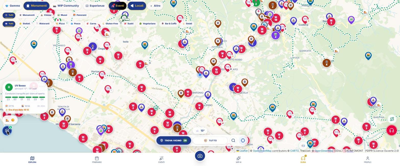
- Round pins with an emoji, grouped in green bubbles with a number. The pin indicates the starting point of the route, not the path.
- Green dotted paths (canoeing is blue). When zooming in, simple lines appear first, then solid ones and, from zoom 13, numbered stages.
- Emojis: 🐴 horse-riding trails · 🏔 Sentiero Italia (CAI) · 🎒 main trails · 🏃 running · 🛶 canoeing · 🏛 historic itineraries · 🥾 other. 🏔 “Mountain hut” from zoom 12 (up to 60), only if the Snow layer is off.
- There is no legend: you can tell from the emoji and the colour.
Zoom visibility
It appears even at low zoom. From zoom 4 you see simplified lines; from 11 solid lines; from 13 stages. Below zoom 10 you only see the main routes; from 12 also local ones, horse-riding trails, running and canoeing.
What you see when you tap
- The pin opens a bubble: “{emoji} name”, a description line and “Starting point · © OpenStreetMap contributors”.
- The track shows name and km; a calculated route says “route reconstructed between stages”.
- A stage shows “Stage N · location” and notes. There are no buttons or links.
Where the data comes from
OpenStreetMap (ODbL), CAI INFOMONT and French PDIPR (Licence Ouverte 2.0). Information updates when you move the map by more than 400 m or change zoom.
Options and combinations
Options: No internal filters or switches.
With other layers: It adds to Cycle routes and MTB and Wine and food. With Snow on, mountain huts are drawn by Snow.
What WIP does not do (so you know what to expect)
- No elevation gain, difficulty, duration, GPX or closures.
- The pin is the start: the stages are locations.
- In dense areas, local trails are cut off (maximum 120 pins below zoom 12, 200 from 12).
Frequently asked questions
Does the “Trails and pilgrim ways” layer have a filter?
No internal filters or switches.
Why can't I see it?
Check that you have turned the layer on and are close enough: if “zoom in to see them” appears, zoom in on the area.
Continue with
Map layers
All 12 WIP map layers: trails, bike paths, wine and food, drinking fountains, protected areas and species, sho…
Trails and cycle routes
Step by step: turn on the Trails and Cycle routes levels on WIP, read the tracks, find nearby shelters and fou…
Nature and routes
How to find lakes, waterfalls, peaks, caves, parks, trails and cycle routes with WIP, and which route data act…
Content checked against the app code on 16 November 2026. If something does not match what you see, write to support@wip.guide.