WIP › Guide › Map and search › Map layers
The 12 WIP map layers: what they show and how to use them
The Layers button (bottom left) turns on information layers above the map. There are 12, in three groups. Each has a guide with what it draws, at what zoom it appears, what you read by tapping, where the data comes from and its limits.
Translated from Italian. Screenshots, videos and examples show the app in Italian.
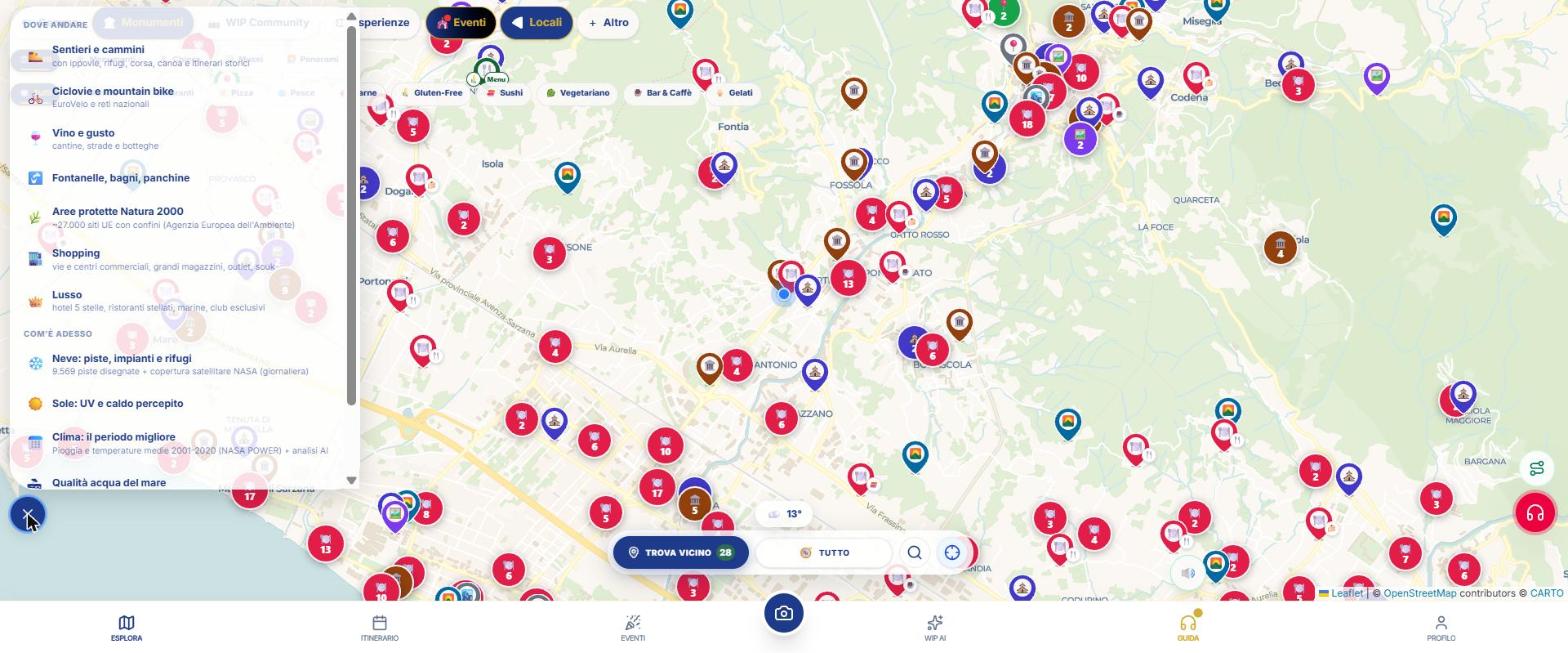
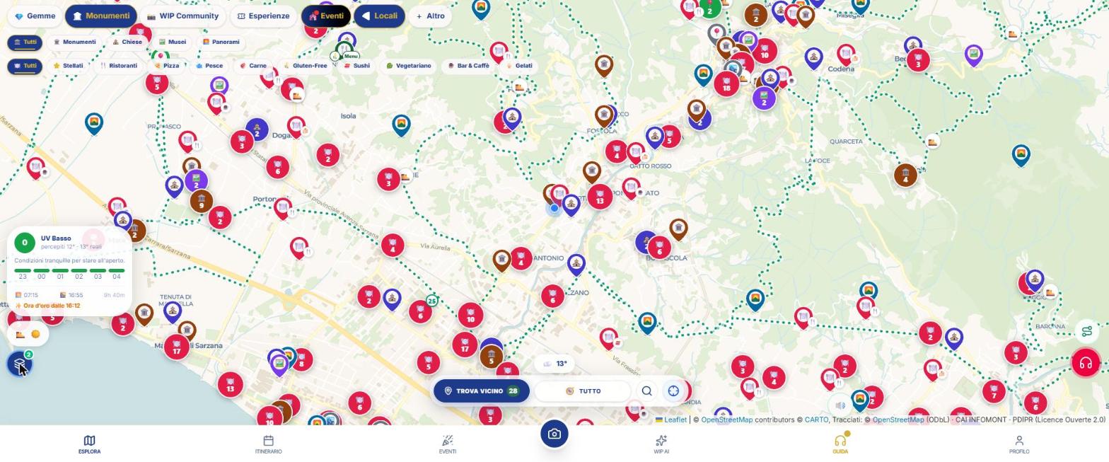
How the panel works
- On the map, tap the circle with the layers («Map layers») at the bottom left.
- Find the group («Where to go», «How it is now» or «Background») and tap the layer row: the row colors and a ✓ appears (a spinner while loading).
- Close the panel: next to the button, the emojis of the active layers and a dot with the number remain. Tap them to reopen.
- To turn it off, tap the row again, or «Turn off all (n)».
- The layers add up and your choice is remembered between sessions: an active layer restarts on its own when reopened.
- «↗ zoom in to see them»: the layer is on but you are too far away.
- If you have an open info card, the layer does not reload until you close it.
- Layers do not have an audio guide: they show, they don't tell.
The twelve layers
| Group | Layer | In a row |
|---|---|---|
| Where to go | 🥾 Trails and paths | with horseback riding trails, mountain huts, running, canoeing and historical itineraries |
| Where to go | 🚲 Cycle routes and mountain bike | EuroVelo and national networks |
| Where to go | 🍷 Wine and taste | wineries, wine roads and shops |
| Where to go | 🚰 Fountains, restrooms, benches | (water points, restrooms and benches) |
| Where to go | 🌿 Protected areas around the world and their species | 236,172 parks, reserves and Natura 2000 sites worldwide, with boundaries and sighted species |
| Where to go | 🏬 Shopping | streets and shopping centers, department stores, outlets, souks |
| Where to go | 👑 Luxury | 5-star hotels, starred restaurants, marinas, exclusive clubs |
| How it is now | ❄️ Snow: slopes, lifts and huts | 9,569 mapped slopes + NASA satellite coverage (daily) |
| How it is now | ☀️ Sun: UV and perceived heat | (card with UV index, peak hours, sunrise and sunset) |
| How it is now | 📅 Climate: the best time | Rain and average temperatures 2001-2020 (NASA POWER) + AI analysis |
| How it is now | 🏖 Sea water quality | (European bathing water classification) |
| Background | 🛰️ Satellite | Aerial photo instead of the map |
When you need several together
- Bike ride: 🚲 Bike paths + 🚰 Drinking fountains + ☀️ Sun.
- Hike: 🥾 Trails + ☀️ Sun + 📅 Climate + 🌿 Protected areas.
- Snow weekend: ❄️ Snow + ☀️ Sun.
- Beach day: 🏖 Water quality + ☀️ Sun.
- Tasting tour: 🍷 Wine and food + 🚲 Bike paths.
- To see from above: 🛰️ Satellite underneath all the others.
What WIP does not do (so you know what to expect)
- No layer has internal filters.
- Webcams, tides and Blue Flag do not exist; ZTL traffic zones are no longer available.
Frequently asked questions
Why is the layer on but I don't see anything?
You are probably too far away: zoom in on the area («zoom in to see them»).
Do the layers stay on?
Yes: the app remembers which ones you have turned on.
Continue with
Thematic maps
All chips, sub-filters, themes (spas, cinema, skies, street art, markets, blossoms, memory, slow travel) and t…
Map and search
How to use the WIP map: category chips, layers, city search, location, weather and place card with photos, des…
Trails and pilgrim ways
The WIP map layer “Trails and pilgrim ways”: what it shows, zoom levels, what you see when you tap, data sourc…
Cycle routes and MTB
The WIP map layer “Cycle routes and MTB”: what it shows, zoom levels, what you see when you tap, data sources …
Wine & Taste
The WIP map "Wine & food" layer: what it draws, at what zoom level it appears, what you can read by tapping, d…
Content checked against the app code on 16 November 2026. If something does not match what you see, write to support@wip.guide.